Agrinio – Kryoneri (western Greece)
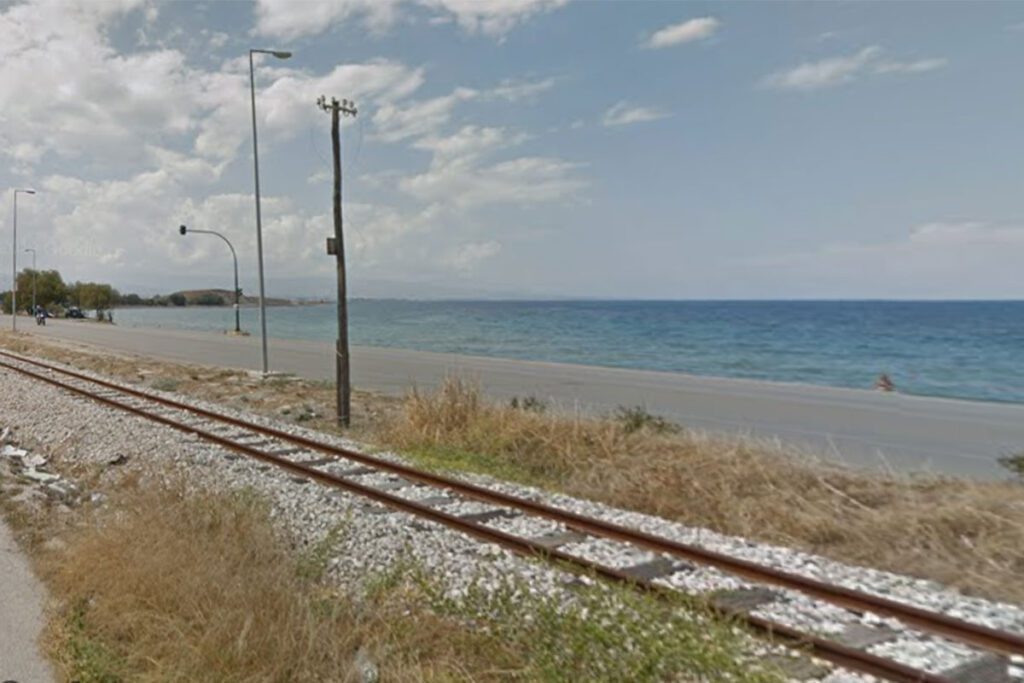
website: / website: / website: website: website: website: website: / / / / / Owner/holder of the abandoned railway: Owner/holder of the abandoned railway: Owner/holder of the abandoned railway: Owner/holder of the abandoned railway: Owner/holder of the abandoned railway: gpx file: gpx file: gpx file: gpx file: gpx file: These railways started to be built in the late 19th century and officially suspended in 1980. The buildings, facilities and all rails were abandoned while some of the stations were demolished in order to build other public buildings (e.g. schools). Most of the railway heritage was destroyed and vandalized throughout the time. At the moment, the trails are abandoned, moved and/or destroyed. In some parts the rails have been moved away and used for other purposes (e.g. roads). As it can be seen from the photos, the rails go through residential areas, near houses and other buildings while crossing roads and rural roads. These railways started to be built in the late 19th century and officially suspended in 1980. The buildings, facilities and all rails were abandoned while some of the stations were demolished in order to build other public buildings (e.g. schools). Most of the railway heritage was destroyed and vandalized throughout the time. At the moment, the trails are abandoned, moved and/or destroyed. In some parts the rails have been moved away and used for other purposes (e.g. roads). As it can be seen from the photos, the rails go through residential areas, near houses and other buildings while crossing roads and rural roads. These railways started to be built in the late 19th century and officially suspended in 1980. The buildings, facilities and all rails were abandoned while some of the stations were demolished in order to build other public buildings (e.g. schools). Most of the railway heritage was destroyed and vandalized throughout the time. At the moment, the trails are abandoned, moved and/or destroyed. In some parts the rails have been moved away and used for other purposes (e.g. roads). As it can be seen from the photos, the rails go through residential areas, near houses and other buildings while crossing roads and rural roads. These railways started to be built in the late 19th century and officially suspended in 1980. The buildings, facilities and all rails were abandoned while some of the stations were demolished in order to build other public buildings (e.g. schools). Most of the railway heritage was destroyed and vandalized throughout the time. At the moment, the trails are abandoned, moved and/or destroyed. In some parts the rails have been moved away and used for other purposes (e.g. roads). As it can be seen from the photos, the rails go through residential areas, near houses and other buildings while crossing roads and rural roads. Total distance: 60806 mTotal climbing: 319 mTotal descent: -251 m Total distance: 60806 m Total distance: 60806 m Total climbing: 319 m Total climbing: 319 m Total descent: -251 m Total descent: -251 m These railways are totally destroyed. There are few points of interest in the area since the trails goes through the natural landscapes and small villages as well as connect the biggest cities of the region of Aitoloakarnania – Messologgi and Agrinio. The trails lie near Acheloos river as well as the lake Trichonida with high visiting potentials. Additionally, the area has interesting monuments with archeological interest such as “The ancient theater of Kalydon” and the “Ancient Theater of New Pleuron”. The area also has regional buses which connect the region with the country’s biggest cities and it is worth mentioning that it’s near the Ionian sea, an area with high visitation rate. These railways are totally destroyed. There are few points of interest in the area since the trails goes through the natural landscapes and small villages as well as connect the biggest cities of the region of Aitoloakarnania – Messologgi and Agrinio. The trails lie near Acheloos river as well as the lake Trichonida with high visiting potentials. Additionally, the area has interesting monuments with archeological interest such as “The ancient theater of Kalydon” and the “Ancient Theater of New Pleuron”. The area also has regional buses which connect the region with the country’s biggest cities and it is worth mentioning that it’s near the Ionian sea, an area with high visitation rate. These railways are totally destroyed. There are few points of interest in the area since the trails goes through the natural landscapes and small villages as well as connect the biggest cities of the region of Aitoloakarnania – Messologgi and Agrinio. The trails lie near Acheloos river as well as the lake Trichonida with high visiting potentials. Additionally, the area has interesting monuments with archeological interest such as “The ancient theater of Kalydon” and the “Ancient Theater of New Pleuron”. The area also has regional buses which connect the region with the country’s biggest cities and it is worth mentioning that it’s near the Ionian sea, an area with high visitation rate. recommended you read The area is completely rural and it offers nice landscapes. The potential greenway goes through small towns which give the opportunity to the visitors to use public transportation as a starting point. The potential greenway would be a good option for biking, running and walking. Additionally any outdoor activities can be implemented in the different areas. The area is completely rural and it offers nice landscapes. The potential greenway goes through small towns which give the opportunity to the visitors to use public transportation as a starting point. The potential greenway would be a good option for biking, running and walking. Additionally any outdoor activities can be implemented in the different areas. The area is completely rural and it offers nice landscapes. The potential greenway goes through small towns which give the opportunity to the visitors to use public transportation as a starting point. The potential greenway would be a good option for biking, running and walking. Additionally any outdoor activities can be implemented in
Agrinio – Kryoneri (western Greece) Read More »